The following is a sequence of high resolution satellite images taken before and after the earthquake.
Images were obtained from different sources. Credits: Google, DigitalGlobe and GeoEye.
 |
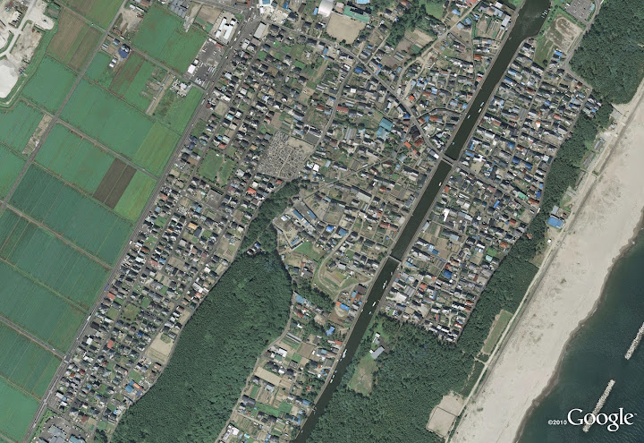
| Arahama in Sendai in 2008. © 2011 Google, DigitalGlobe 2008年 宮城県仙台市若林区荒浜 © 2011 Google, DigitalGlobeImag |
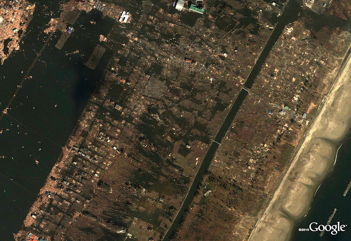 | ||||
| Arahama in Sendai after tsunami. © 2011 Google, GeoEye 被災後 宮城県仙台市若林区荒浜(現地2011/3/12 撮影) © 2011 Google, GeoEye |
 | |
| Yuriage in Natori in 2008. © 2011 Google, DigitalGlobe 2008 年 宮城県名取市閖上 © 2011 Google, DigitalGlobe |
 |
| Yuriage in Natori after tsunami. © 2011 Google, GeoEye 被災後 宮城県名取市閖上(現地2011/3/12 撮影) © 2011 Google, GeoEye |
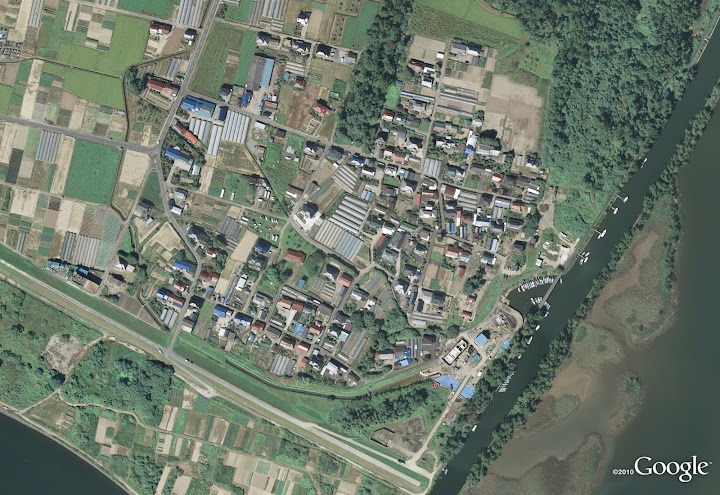 |
| Fujitsuka in Sendai in 2008. © 2011 Google, DigitalGlobe 2008年 宮城県仙台市若林区藤塚 © 2011 Google, DigitalGlobe |
 |
| Fujitsuka in Sendai after tsunami. © 2011 Google, GeoEye 被災後 宮城県仙台市若林区藤塚(現地2011/3/12 撮影) © 2011 Google, GeoEye |
 |
| Sendai airport in 2003. © 2011 Google, DigitalGlobe 2003年 仙台空港(宮城県名取市) © 2011 Google, DigitalGlobe |
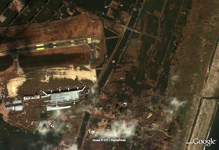 |
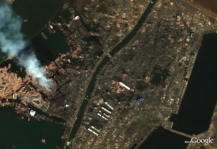
| Sendai Airport after tsunami. © 2011 Google, GeoEye 被災後 仙台空港(宮城県名取市)(現地2011/3/12 撮影) © 2011 Google, GeoEye |
No comments:
Post a Comment